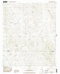
1996 Map of McLeod Tank
USGS Topo · Published 2002About this map
The Caballo Mountains and Mc Leod Hills dominate this high-desert landscape in southern New Mexico, where water management is the primary marker of human presence. Named for the essential infrastructure of the ranching economy, features like McLeod Tank, Broken House Tank, and Escondido Tank are distributed across the arid terrain to catch runoff. The map records the intersection of the Sierra and Doña Ana county line as it crosses through Redhouse Mountain. Settlement is sparse, represented by locations like Garfield and McLeod, with travel defined by drainages such as McLeod Draw and the broad Broadhurst arroyo. This provisional survey captures the region just before the turn of the 21st century, detailing a network of 4WD trails and unimproved roads that navigate the complex system of canyons including North Green Canyon.
Find a feature on this map
25 named features on this map. Tap any name to fly to it.
Don’t see what you’re looking for? This feature index may not catch every label — zoom into the map to look around manually.
Map Details
Editions of this 1996 McLeod Tank Map
This is the sole edition of this map. No revisions or reprints were ever made.
Other maps of this area

1955 · Las Cruces
USGS Topo · 1:250,000

1958 · Las Cruces
USGS Topo · 1:250,000

1958 · Arroyo Cuervo
USGS Topo · 1:24,000

1959 · Hatch
USGS Topo · 1:24,000

1959 · Rincon
USGS Topo · 1:24,000

1959 · Upham
USGS Topo · 1:62,500

1961 · Caballo
USGS Topo · 1:24,000

1961 · Nutt
USGS Topo · 1:62,500

1961 · Garfield
USGS Topo · 1:24,000

1982 · Hatch
USGS Topo · 1:100,000