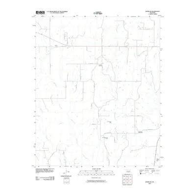
2009 Map of McMillan
USGS Topo · Published 2009About this map
Wilson Creek and Little Hauani Creek drain this landscape in eastern Love County, where the topography is defined by small-scale water management and a network of rural roads. The area features several private and named earthen structures, including the Jim Conrad Dam and Milford Clement Dam, which speak to the regional focus on livestock ponds and water retention. For genealogists and family researchers, the map identifies local burial sites such as McMillan Cemetery and Wilson Cemetery, providing precise locations for these heritage markers. The grid of country routes, from Dickson Rd to Griffin Mountain Rd, underscores a late-century settlement pattern that balances remote rural homesteads with the primary thoroughfare of Highway 70.
Find a feature on this map
40 named features on this map. Tap any name to fly to it.
Don’t see what you’re looking for? This feature index may not catch every label — zoom into the map to look around manually.
Map Details
Editions of this 2009 McMillan Map
This is the sole edition of this map. No revisions or reprints were ever made.
Other maps of this area

1901 · Tishomingo
USGS Topo · 1:125,000

1901 · Ardmore
USGS Topo · 1:125,000

1901 · Denison
USGS Topo · 1:125,000

1902 · Gainesville
USGS Topo · 1:125,000

1918 · Ardmore
USGS Topo · 1:125,000

1943 · Gainesville
USGS Topo · 1:125,000

1954 · Sherman
USGS Topo · 1:250,000

1957 · Ardmore
USGS Topo · 1:250,000

1958 · Gordonville
USGS Topo · 1:62,500

1958 · Sherman
USGS Topo · 1:250,000