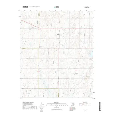
2018 Map of McMillan
USGS Topo · Published 2018About this map
McMillan and Tyler anchor the high ground along the tri-county border where Carter, Marshall, and Love counties meet. The landscape is defined by a dense network of watercourses and localized reservoirs, including the Milford Clement Reservoir in the southeast and Jim Conrad Reservoir further north. This region exhibits a traditional rural settlement pattern where family and community identity is preserved through numerous small burial grounds such as Keel Cem, McMillan Cem, and Hunter Pickens Cem. The drainage of Hauani Cr and Wilson Cr carves through the terrain, dictating the placement of early routes like Red Everett Rd and Keel Cemetery Rd. Near the southern edge, the small settlement of Eville sits along the banks of Boggy Cr, illustrating the long-standing relationship between local geography and community development in this part of Oklahoma.
Find a feature on this map
61 named features on this map. Tap any name to fly to it.
Don’t see what you’re looking for? This feature index may not catch every label — zoom into the map to look around manually.
Map Details
Editions of this 2018 McMillan Map
This is the sole edition of this map. No revisions or reprints were ever made.
Other maps of this area

1901 · Tishomingo
USGS Topo · 1:125,000

1901 · Ardmore
USGS Topo · 1:125,000

1901 · Denison
USGS Topo · 1:125,000

1902 · Gainesville
USGS Topo · 1:125,000

1918 · Ardmore
USGS Topo · 1:125,000

1943 · Gainesville
USGS Topo · 1:125,000

1954 · Sherman
USGS Topo · 1:250,000

1957 · Ardmore
USGS Topo · 1:250,000

1958 · Gordonville
USGS Topo · 1:62,500

1958 · Sherman
USGS Topo · 1:250,000