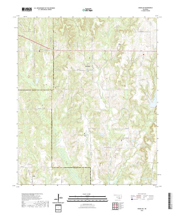
2022 Map of McMillan
USGS Topo · Published 2022About this map
The settlement of McMillan serves as a central hub in this landscape where Marshall, Carter, and Love Counties meet. The terrain is defined by a dense network of intermittent streams, including Wilson Cr, Buggy Cr, and Little Hauani Cr, which feed into modern water management features like the Jim Conrad Reservoir and the Milford Clement Reservoir. Small communities such as Tyler in the northeast and Eville in the southwest are connected by an intricate grid of county roads, many bearing local family names like Dickson Rd and Savage Rd.
Find a feature on this map
64 named features on this map. Tap any name to fly to it.
Don’t see what you’re looking for? This feature index may not catch every label — zoom into the map to look around manually.
Map Details
Editions of this 2022 McMillan Map
This is the sole edition of this map. No revisions or reprints were ever made.
Other maps of this area

1901 · Tishomingo
USGS Topo · 1:125,000

1901 · Ardmore
USGS Topo · 1:125,000

1901 · Denison
USGS Topo · 1:125,000

1902 · Gainesville
USGS Topo · 1:125,000

1918 · Ardmore
USGS Topo · 1:125,000

1943 · Gainesville
USGS Topo · 1:125,000

1954 · Sherman
USGS Topo · 1:250,000

1957 · Ardmore
USGS Topo · 1:250,000

1958 · Gordonville
USGS Topo · 1:62,500

1958 · Sherman
USGS Topo · 1:250,000