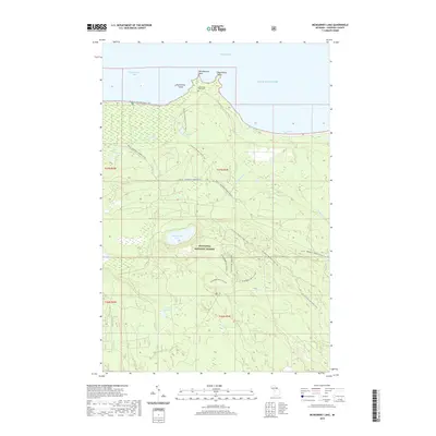
2019 Map of McNearney Lake
USGS Topo · Published 2019About this map
Whitefish Bay and Tahquamenon Bay define this northern coastline within the Hiawatha National Forest. This section of the Upper Peninsula is characterized by complex hydrology and specialized recreational routes. Along the Lake Superior shoreline, features like Menekaunee Point and Naomikong Island offer historical landmarks for navigation and local heritage. Inland, the landscape is woven with water bodies including McNearney Lake, Naomikong Pond, and Peck and Rye Lake. The presence of the Naomikong Point Cem provides a specific point of interest for genealogists studying early coastal activity. A modern network of trails, such as the N Country National Scenic Trail and various snow-based routes like McNearney Ski-C (Snow), illustrates how the forest is currently utilized for winter sports and long-distance hiking.
Find a feature on this map
25 named features on this map. Tap any name to fly to it.
Don’t see what you’re looking for? This feature index may not catch every label — zoom into the map to look around manually.
Map Details
Editions of this 2019 McNearney Lake Map
This is the sole edition of this map. No revisions or reprints were ever made.
Other maps of this area

1941 · Strongs
USGS Topo · 1:63,360

1951 · Strongs
USGS Topo · 1:24,000

1951 · McNearney Lake
USGS Topo · 1:24,000

1951 · Pendills Lake
USGS Topo · 1:24,000

1951 · Emerson
USGS Topo · 1:24,000

1951 · Piatt Lake
USGS Topo · 1:24,000

1951 · Sullivan Creek
USGS Topo · 1:24,000

1951 · Eckerman
USGS Topo · 1:24,000

1951 · Strongs
USGS Topo · 1:62,500

1951 · Eckerman
USGS Topo · 1:62,500