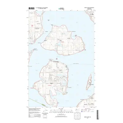
2014 Map of McNeil Island
USGS Topo · Published 2014About this map
McNeil Island and Anderson Island dominate this coastal survey of the southern Puget Sound region. On McNeil Island, the presence of the Prison Farm Sewage Lagoon and the Butterworth Reservoir point to the island's long history as a site for state and federal correctional facilities, with small settlements like Gertrude and Bee punctuating the shoreline. Across Balch Passage, Anderson Island shows a denser network of local roads and recreational water bodies such as Florence Lake and Josephine Lake. Navigational aids, including the McDermott Point Lighthouse and Drayton Light, underscore the importance of maritime safety in these complex waterways. The map also documents several cemeteries, including Hillcrest Cem and Anderson Island Cem, which are valuable for genealogical research in these isolated island communities. Near the mainland, the Steilacoom - Anderson Ferry route connects the islands to the larger Pierce County infrastructure.
Find a feature on this map
121 named features on this map. Tap any name to fly to it.
Don’t see what you’re looking for? This feature index may not catch every label — zoom into the map to look around manually.
Map Details
Editions of this 2014 McNeil Island Map
This is the sole edition of this map. No revisions or reprints were ever made.
Other maps of this area

1937 · Olympia
USGS Topo · 1:62,500

1938 · Allyn
USGS Topo · 1:62,500

1940 · Anderson Island
USGS Topo · 1:62,500

1942 · Gig Harbor
USGS Topo · 1:62,500

1943 · Gig Harbor
USGS Topo · 1:62,500

1948 · Anderson Island
USGS Topo · 1:62,500

1948 · Fort Lewis
USGS Topo · 1:24,000

1948 · Nisqually
USGS Topo · 1:24,000

1948 · Anderson Island
USGS Topo · 1:24,000

1948 · Steilacoom
USGS Topo · 1:24,000