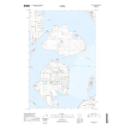
2020 Map of McNeil Island
USGS Topo · Published 2020About this map
McNeil Island and Anderson Island dominate this coastal landscape within the Puget Sound, illustrating a maritime community defined by its isolated geography and specialized land use. On McNeil Island, the presence of the Prison Farm Sewage Lagoon and numerous water bodies like Butterworth Reservoir and Floyd Cove Reservoir highlight the island's unique infrastructure. The map documents the vital transport links required for island life, specifically the McNeil Island Ferry and the Steilacoom Ferry routes. Anderson Island reveals a more residential character, with a grid of named roads such as Otso Point Rd and Villa Beach Rd surrounding Florence Lake and Josephine Lake. For genealogists, the Hillcrest Cem and Anderson Island Cem are significant landmarks for tracing local family histories within Pierce County.
Find a feature on this map
119 named features on this map. Tap any name to fly to it.
Don’t see what you’re looking for? This feature index may not catch every label — zoom into the map to look around manually.
Map Details
Editions of this 2020 McNeil Island Map
This is the sole edition of this map. No revisions or reprints were ever made.
Other maps of this area

1937 · Olympia
USGS Topo · 1:62,500

1938 · Allyn
USGS Topo · 1:62,500

1940 · Anderson Island
USGS Topo · 1:62,500

1942 · Gig Harbor
USGS Topo · 1:62,500

1943 · Gig Harbor
USGS Topo · 1:62,500

1948 · Anderson Island
USGS Topo · 1:62,500

1948 · Fort Lewis
USGS Topo · 1:24,000

1948 · Nisqually
USGS Topo · 1:24,000

1948 · Anderson Island
USGS Topo · 1:24,000

1948 · Steilacoom
USGS Topo · 1:24,000