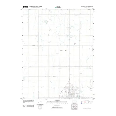
2009 Map of McPherson North
USGS Topo · Published 2009About this map
The northern reaches of McPherson anchor the southern edge of this Central Kansas landscape, where the urban grid begins to dissolve into the organized section lines of the prairie. Residential development and established streets like N Main St and Wickersham Dr give way to a network of named rural roads, including Pawnee Rd and Limestone Rd. This transition zone is defined by the headwaters of several drainage systems, notably Bull Creek and Dry Turkey Creek, which carve gentle paths through the agricultural lands. Farther north, the small rural nodes of Johnstown and Hilton persist as markers of local identity along the section corners. The presence of Crestwood Memorial Park and the prominent US Hwy 81 Byp corridor illustrate the modern infrastructure supporting this hub of the Kansas wheat belt in the early 21st century.
Find a feature on this map
42 named features on this map. Tap any name to fly to it.
Don’t see what you’re looking for? This feature index may not catch every label — zoom into the map to look around manually.
Map Details
Editions of this 2009 McPherson North Map
This is the sole edition of this map. No revisions or reprints were ever made.
Other maps of this area

1891 · Hutchinson
USGS Topo · 1:125,000

1892 · Salina
USGS Topo · 1:125,000

1893 · Hutchinson
USGS Topo · 1:125,000

1942 · Salina
USGS Topo · 1:125,000

1955 · Hutchinson
USGS Topo · 1:250,000

1959 · Hutchinson
USGS Topo · 1:250,000

1964 · Marquette
USGS Topo · 1:24,000

1964 · Conway
USGS Topo · 1:24,000

1965 · Mc Pherson South
USGS Topo · 1:24,000

1965 · Galva
USGS Topo · 1:24,000