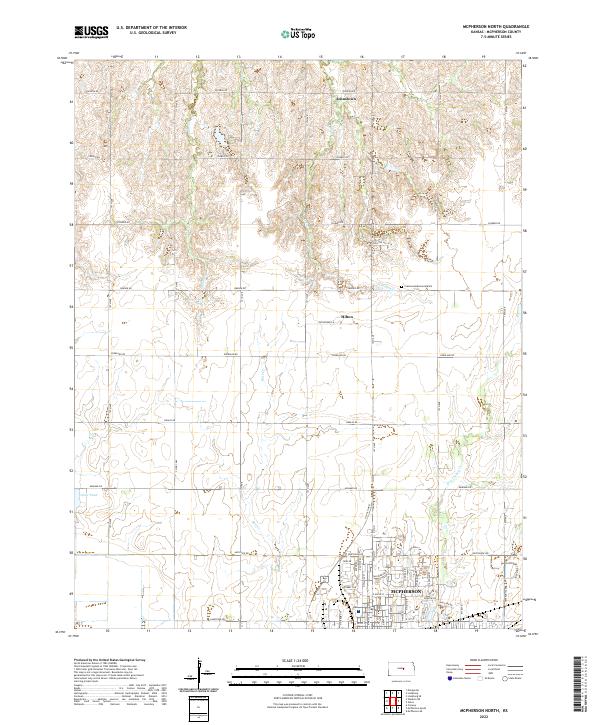
2022 Map of McPherson North
USGS Topo · Published 2022About this map
The northern reaches of McPherson anchor the southern edge of this landscape, where residential developments meet the agricultural expanse of central Kansas. Modern street grids including Northview Ave and Darlow Dr give way to a network of rural roads with names like Quivera Rd and Pawnee Rd, reflecting the regional heritage. The terrain is defined by the subtle drainage patterns of Bull Creek and Dry Turkey Creek, which carve gentle undulations across the plains. Small, unincorporated communities such as Johnstown and Hilton are located north of the city center, marking historic points of settlement along the section lines. This modern survey demonstrates the persistence of the original township and range system, with t18s r3w and surrounding sections maintaining their geometric integrity even as the city of McPherson expands toward Crestwood Memorial Park.
Find a feature on this map
53 named features on this map. Tap any name to fly to it.
Don’t see what you’re looking for? This feature index may not catch every label — zoom into the map to look around manually.
Map Details
Editions of this 2022 McPherson North Map
This is the sole edition of this map. No revisions or reprints were ever made.
Other maps of this area

1891 · Hutchinson
USGS Topo · 1:125,000

1892 · Salina
USGS Topo · 1:125,000

1893 · Hutchinson
USGS Topo · 1:125,000

1942 · Salina
USGS Topo · 1:125,000

1955 · Hutchinson
USGS Topo · 1:250,000

1959 · Hutchinson
USGS Topo · 1:250,000

1964 · Marquette
USGS Topo · 1:24,000

1964 · Conway
USGS Topo · 1:24,000

1965 · Mc Pherson South
USGS Topo · 1:24,000

1965 · Galva
USGS Topo · 1:24,000