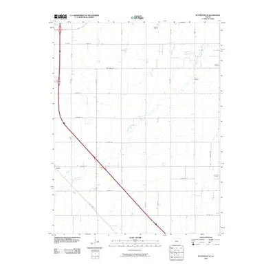
2009 Map of McPherson SE
USGS Topo · Published 2009About this map
Elyria serves as the primary settlement hub in this 2009 survey of the agricultural landscape southeast of McPherson. The terrain is defined by a grid of named rural routes and the meandering paths of Turkey Creek, Running Turkey Creek, and Sand Creek. For genealogists and local historians, the map is particularly useful for locating burial grounds such as Dunkard Cemetery, Empire Cemetery, and Lone Tree Cemetery, which anchor the surrounding farmstead blocks. The transportation network shows a transition in prairie travel, featuring both the modern interstate corridor and the legacy of Old US Hwy 81, alongside distinctively named local thoroughfares like Chisholm Rd and Iron Horse Rd. This documentation captures the precise layout of McPherson County's rural infrastructure at the end of the decade.
Find a feature on this map
26 named features on this map. Tap any name to fly to it.
Don’t see what you’re looking for? This feature index may not catch every label — zoom into the map to look around manually.
Map Details
Editions of this 2009 McPherson SE Map
This is the sole edition of this map. No revisions or reprints were ever made.
Other maps of this area

1889 · Newton
USGS Topo · 1:125,000

1891 · Hutchinson
USGS Topo · 1:125,000

1893 · Hutchinson
USGS Topo · 1:125,000

1894 · Newton
USGS Topo · 1:125,000

1955 · Hutchinson
USGS Topo · 1:250,000

1959 · Hutchinson
USGS Topo · 1:250,000

1965 · Mc Pherson South
USGS Topo · 1:24,000

1965 · Galva
USGS Topo · 1:24,000

1965 · Halstead NW
USGS Topo · 1:24,000
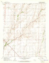
1965 · Mc Pherson SE
USGS Topo · 1:24,000