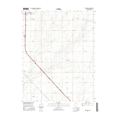
2015 Map of McPherson SE
USGS Topo · Published 2015About this map
Turkey Creek and Running Turkey Creek meander through this agricultural landscape south of McPherson. The terrain is characterized by a grid of rural section roads, including historic naming conventions like Chisholm Rd and Cimarron Rd, which reflect the region's deep ties to early transit and cattle trails. The small settlement of Elyria sits in the southwest, while the outskirts of the larger town are visible at the northern edge.
Find a feature on this map
27 named features on this map. Tap any name to fly to it.
Don’t see what you’re looking for? This feature index may not catch every label — zoom into the map to look around manually.
Map Details
Editions of this 2015 McPherson SE Map
This is the sole edition of this map. No revisions or reprints were ever made.
Other maps of this area

1889 · Newton
USGS Topo · 1:125,000

1891 · Hutchinson
USGS Topo · 1:125,000

1893 · Hutchinson
USGS Topo · 1:125,000

1894 · Newton
USGS Topo · 1:125,000

1955 · Hutchinson
USGS Topo · 1:250,000

1959 · Hutchinson
USGS Topo · 1:250,000

1965 · Mc Pherson South
USGS Topo · 1:24,000

1965 · Galva
USGS Topo · 1:24,000

1965 · Halstead NW
USGS Topo · 1:24,000
1965 · Mc Pherson SE
USGS Topo · 1:24,000