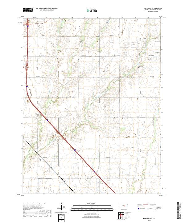
2022 Map of McPherson SE
USGS Topo · Published 2022About this map
Running Turkey Creek and Turkey Creek wind through the agricultural landscape southeast of the city, defining the drainage patterns of this section of McPherson County. The terrain is structured by a rigorous section-line grid of roads, including historical corridors like Old US Hwy 81 and the evocative Chisholm Road, which recall the area's long history as a transit corridor across the Kansas plains.
Find a feature on this map
30 named features on this map. Tap any name to fly to it.
Don’t see what you’re looking for? This feature index may not catch every label — zoom into the map to look around manually.
Map Details
Editions of this 2022 McPherson SE Map
This is the sole edition of this map. No revisions or reprints were ever made.
Other maps of this area

1889 · Newton
USGS Topo · 1:125,000

1891 · Hutchinson
USGS Topo · 1:125,000

1893 · Hutchinson
USGS Topo · 1:125,000

1894 · Newton
USGS Topo · 1:125,000

1955 · Hutchinson
USGS Topo · 1:250,000

1959 · Hutchinson
USGS Topo · 1:250,000

1965 · Mc Pherson South
USGS Topo · 1:24,000

1965 · Galva
USGS Topo · 1:24,000

1965 · Halstead NW
USGS Topo · 1:24,000
1965 · Mc Pherson SE
USGS Topo · 1:24,000