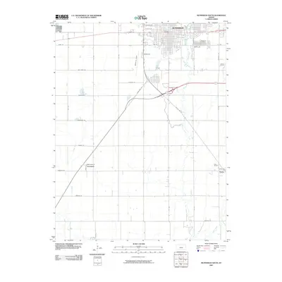
2009 Map of McPherson South
USGS Topo · Published 2009About this map
The city of McPherson serves as the focal point of this 2009 survey, showcasing the southern expansion of the community and its surrounding agricultural and industrial landscape. The map details the transition from urban residential blocks near the McPherson Post Office to the open prairie, where energy production is evident in the Johnson Oil Field and Elyria Oil Field. Transportation corridors like State Spur 153 and Old US Hwy 81 cut through the terrain, connecting the larger hub with smaller outlying settlements such as Groveland and Elyria.
Find a feature on this map
31 named features on this map. Tap any name to fly to it.
Don’t see what you’re looking for? This feature index may not catch every label — zoom into the map to look around manually.
Map Details
Editions of this 2009 McPherson South Map
This is the sole edition of this map. No revisions or reprints were ever made.
Other maps of this area

1891 · Hutchinson
USGS Topo · 1:125,000

1893 · Hutchinson
USGS Topo · 1:125,000

1955 · Hutchinson
USGS Topo · 1:250,000

1959 · Hutchinson
USGS Topo · 1:250,000

1964 · Conway
USGS Topo · 1:24,000

1965 · Mc Pherson South
USGS Topo · 1:24,000

1965 · Galva
USGS Topo · 1:24,000

1965 · Halstead NW
USGS Topo · 1:24,000
1965 · Mc Pherson SE
USGS Topo · 1:24,000
1965 · Mc Pherson North
USGS Topo · 1:24,000