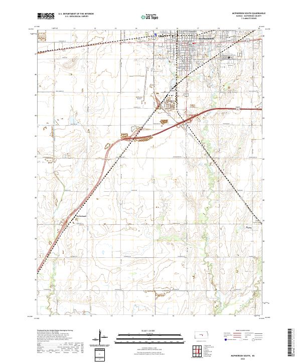
2022 Map of McPherson South
USGS Topo · Published 2022About this map
McPherson and its southern agricultural hinterlands are defined by a grid of rural roads and the winding paths of Blaze Fork and Dry Turkey Creek. The city itself is a hub of higher education, anchored by McPherson College and the Central Christian College of Kansas. At the heart of the community stands the McPherson County Courthouse, surrounded by a dense residential and commercial street plan including historic thoroughfares like Chisholm Rd and Old US Hwy 81. To the south, the small settlements of Groveland and Elyria reflect the region's enduring farming roots, while the McPherson Airport and McPherson Cem serve as essential local landmarks. This landscape maintains a clear distinction between the organized municipal layout of the north and the expansive, creek-fed fields that stretch toward the southern boundaries.
Find a feature on this map
44 named features on this map. Tap any name to fly to it.
Don’t see what you’re looking for? This feature index may not catch every label — zoom into the map to look around manually.
Map Details
Editions of this 2022 McPherson South Map
This is the sole edition of this map. No revisions or reprints were ever made.
Other maps of this area

1891 · Hutchinson
USGS Topo · 1:125,000

1893 · Hutchinson
USGS Topo · 1:125,000

1955 · Hutchinson
USGS Topo · 1:250,000

1959 · Hutchinson
USGS Topo · 1:250,000

1964 · Conway
USGS Topo · 1:24,000

1965 · Mc Pherson South
USGS Topo · 1:24,000

1965 · Galva
USGS Topo · 1:24,000

1965 · Halstead NW
USGS Topo · 1:24,000
1965 · Mc Pherson SE
USGS Topo · 1:24,000
1965 · Mc Pherson North
USGS Topo · 1:24,000