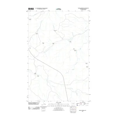
2011 Map of McRae Springs
USGS Topo · Published 2011About this map
Mc Rae Springs and Alexander Springs dot the landscape of McCone County, providing essential water points in this drainage network of coulees and creeks. The terrain is defined by its dramatic relief, including the elevated Caprock Butte and Coal Hill, which overlook the winding paths of Lost Creek and Hungry Creek. This survey captures the rural infrastructure of the early 21st century, where routes like Nickels Rd and River Rd traverse the high ground near Hungry Creek Pass and Sids Flat. The map reveals a complex system of seasonal waterways, from Plum Patch Coulee in the northwest to the broader reaches of Bear Creek in the south, illustrating the natural erosion patterns and land use of the Montana plains.
Find a feature on this map
24 named features on this map. Tap any name to fly to it.
Don’t see what you’re looking for? This feature index may not catch every label — zoom into the map to look around manually.
Map Details
Editions of this 2011 McRae Springs Map
This is the sole edition of this map. No revisions or reprints were ever made.
Other maps of this area

1914 · Nashua
USGS Topo · 1:62,500

1915 · Frazer
USGS Topo · 1:62,500

1916 · Nashua
USGS Topo · 1:62,500

1954 · Jordan
USGS Topo · 1:250,000

1954 · Glasgow
USGS Topo · 1:250,000

1956 · Jordan
USGS Topo · 1:250,000

1957 · Glasgow
USGS Topo · 1:250,000

1958 · Glasgow
USGS Topo · 1:250,000

1958 · Jordan
USGS Topo · 1:250,000

1964 · Jordan
USGS Topo · 1:250,000