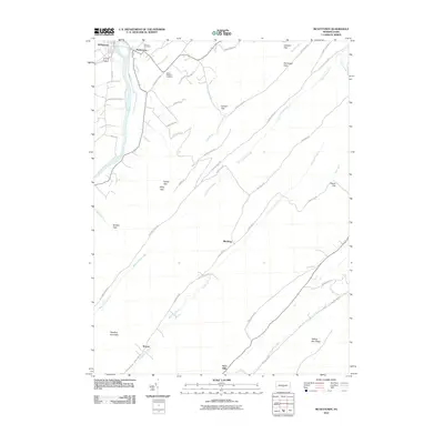
2010 Map of McVeytown
USGS Topo · Published 2010About this map
The Juniata River carves a path through the northwestern corner of this Mifflin County landscape, where the borough of McVeytown and the settlement of Mattawana sit along its banks. The terrain is defined by the recurring parallel ridges and gaps typical of central Pennsylvania, including Bratton Gap, Miller Gap, and Reeds Gap. These natural passes have long dictated the placement of local thoroughfares like E Licking Creek Rd and Black Log Rd, which follow the narrow valleys between Blacklog Mountain and Willow Run Ridge.
Find a feature on this map
51 named features on this map. Tap any name to fly to it.
Don’t see what you’re looking for? This feature index may not catch every label — zoom into the map to look around manually.
Map Details
Editions of this 2010 McVeytown Map
This is the sole edition of this map. No revisions or reprints were ever made.
Other maps of this area

1919 · Mattawana
USGS Topo · 1:62,500

1919 · Menno
USGS Topo · 1:62,500

1922 · Mt Union
USGS Topo · 1:48,000

1924 · Mt. Union
USGS Topo · 1:62,500

1924 · Lewistown
USGS Topo · 1:62,500

1927 · Lewisburg
USGS Topo · 1:62,500

1935 · Allensville
USGS Topo · 1:62,500

1936 · East Waterford
USGS Topo · 1:48,000

1938 · Allensville
USGS Topo · 1:62,500

1941 · East Waterford
USGS Topo · 1:62,500