
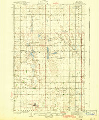
1942 Map of McVille
USGS Topo · Published 1942About this map
McVille anchors this 1930s landscape, serving as a vital rail hub where the Great Northern tracks cut through the southern townships. The survey reveals a meticulously organized rural society, where education and faith are distributed across the prairie in a grid of numbered schools and country steeples. Notable community centers like the Central Farmers Union Hall reflect the region's agricultural cooperation during the mid-century.
Find a feature on this map
38 named features on this map. Tap any name to fly to it.
Don’t see what you’re looking for? This feature index may not catch every label — zoom into the map to look around manually.
Map Details
Editions of this 1942 McVille Map
2 editions found
Other maps of this area

1930 · Pekin
USGS Topo · 1:62,500

1939 · Niagara
USGS Topo · 1:62,500

1951 · Pekin NE
USGS Topo · 1:24,000

1951 · Pekin
USGS Topo · 1:24,000

1951 · Pekin
USGS Topo · 1:62,500

1952 · Grand Forks
USGS Topo · 1:250,000

1952 · Thief River Falls
USGS Topo · 1:250,000

1952 · New Rockford
USGS Topo · 1:250,000

1953 · Devils Lake
USGS Topo · 1:250,000

1956 · New Rockford
USGS Topo · 1:250,000