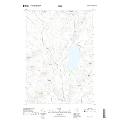
2019 Map of Meacham Lake
USGS Topo · Published 2019About this map
McColloms sits as the primary human settlement in this water-rich expanse of the northern Adirondacks. The landscape is dominated by the sprawling Meacham Lake and a complex network of wetlands and waterways, including the East Branch Saint Regis River and the Osgood River. As part of the Adirondack Park Preserve, the area remains largely undeveloped, defined instead by its glacial topography. Peaks such as Star Mtn, Panther Mtn, and Sugarloaf Mtn rise sharply above a sequence of interconnected ponds and brooks. The drainage patterns are clearly visible, with Clear Brook and Quebec Brook feeding into larger basins, while Santa Clara Rd and Meacham Rd provide the principal corridors through this dense wilderness terrain.
Find a feature on this map
58 named features on this map. Tap any name to fly to it.
Don’t see what you’re looking for? This feature index may not catch every label — zoom into the map to look around manually.
Map Details
Editions of this 2019 Meacham Lake Map
This is the sole edition of this map. No revisions or reprints were ever made.
Other maps of this area

1902 · Saranac
USGS Topo · 1:62,500

1904 · Saranac
USGS Topo · 1:62,500

1905 · Saint Regis
USGS Topo · 1:62,500

1906 · Loon Lake
USGS Topo · 1:62,500

1908 · Loon Lake
USGS Topo · 1:62,500

1921 · Santa Clara
USGS Topo · 1:62,500

1923 · Santa Clara
USGS Topo · 1:62,500

1948 · Ogdensburg
USGS Topo · 1:250,000

1951 · Ogdensburg
USGS Topo · 1:250,000

1953 · Ogdensburg
USGS Topo · 1:250,000