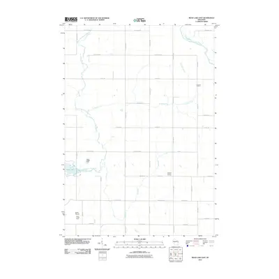
2010 Map of Mead Lake East
USGS Topo · Published 2010About this map
Mead Lake and the South Fork Eau Claire River define the western reaches of this Clark County landscape, where the Mech G4583 Dam regulates the water's flow. The terrain is a mix of lowland river drainage and rising high points, most notably North Mound in the southwest corner, which is overlooked by the Kokaly Lookout Tower. This 2010 survey reveals a highly organized rural grid, where long thoroughfares like Sterling Ave and County Hwy-O provide access to remote woodlots and farmlands.
Find a feature on this map
31 named features on this map. Tap any name to fly to it.
Don’t see what you’re looking for? This feature index may not catch every label — zoom into the map to look around manually.
Map Details
Editions of this 2010 Mead Lake East Map
This is the sole edition of this map. No revisions or reprints were ever made.
Other maps of this area

1948 · Fairchild
USGS Topo · 1:62,500

1949 · Fairchild
USGS Topo · 1:62,500

1952 · Stanley
USGS Topo · 1:62,500

1953 · Neillsville
USGS Topo · 1:62,500

1953 · Owen
USGS Topo · 1:48,000

1953 · Eau Claire
USGS Topo · 1:250,000

1958 · Eau Claire
USGS Topo · 1:250,000

1963 · Owen
USGS Topo · 1:62,500

1964 · Eau Claire
USGS Topo · 1:250,000
1976 · Stanley NE
USGS Topo · 1:24,000