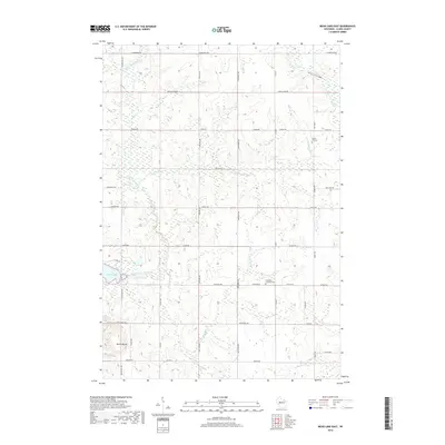
2018 Map of Mead Lake East
USGS Topo · Published 2018About this map
Mead Lake and the winding course of the South Fork Eau Claire River define this rural landscape in eastern Clark County. The terrain is a network of small watercourses, including the Popple River, Norwegian Cr, and Rockin Run, which drain the agricultural lands between wooded patches. A prominent high point, North Mound, rises in the southwest, offering a distinct contrast to the surrounding creek valleys. This modern survey illustrates a long-established grid of country roads, where the intersections of routes like Cloverdale Rd and Resewood Ave organize the farmsteads. Local heritage is preserved at sites such as Forest Hill Cem and the Immanuel Lutheran Cem on Century Rd, marking the spiritual and communal centers for the area's residents.
Find a feature on this map
38 named features on this map. Tap any name to fly to it.
Don’t see what you’re looking for? This feature index may not catch every label — zoom into the map to look around manually.
Map Details
Editions of this 2018 Mead Lake East Map
This is the sole edition of this map. No revisions or reprints were ever made.
Other maps of this area

1948 · Fairchild
USGS Topo · 1:62,500

1949 · Fairchild
USGS Topo · 1:62,500

1952 · Stanley
USGS Topo · 1:62,500

1953 · Neillsville
USGS Topo · 1:62,500

1953 · Owen
USGS Topo · 1:48,000

1953 · Eau Claire
USGS Topo · 1:250,000

1958 · Eau Claire
USGS Topo · 1:250,000

1963 · Owen
USGS Topo · 1:62,500

1964 · Eau Claire
USGS Topo · 1:250,000
1976 · Stanley NE
USGS Topo · 1:24,000