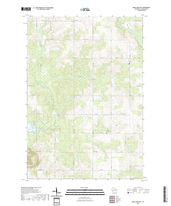
2022 Map of Mead Lake East
USGS Topo · Published 2022About this map
Mead Lake serves as a central landmark in this rural stretch of Clark County, where the hydrology of the Eau Claire River and South Fork Eau Claire River defines the local landscape. The map reveals a deeply etched drainage network, including the Popple River and Black River in the north, alongside numerous smaller tributaries like Norwegian Cr and Rocky Run. The settlement pattern is characterized by a precise grid of rural roads, such as Stark Ave and Sterling Ave, which connect isolated farmsteads and points of local heritage. Genealogists will find particular value in the locations of Forest Hill Cem and the Immanuel Lutheran Cem. In the southwest, North Mound rises as a prominent topographical feature above the surrounding river valleys, anchoring a region that remains defined by its watercourses and steady agricultural layout.
Find a feature on this map
46 named features on this map. Tap any name to fly to it.
Don’t see what you’re looking for? This feature index may not catch every label — zoom into the map to look around manually.
Map Details
Editions of this 2022 Mead Lake East Map
This is the sole edition of this map. No revisions or reprints were ever made.
Other maps of this area

1948 · Fairchild
USGS Topo · 1:62,500

1949 · Fairchild
USGS Topo · 1:62,500

1952 · Stanley
USGS Topo · 1:62,500

1953 · Neillsville
USGS Topo · 1:62,500

1953 · Owen
USGS Topo · 1:48,000

1953 · Eau Claire
USGS Topo · 1:250,000

1958 · Eau Claire
USGS Topo · 1:250,000

1963 · Owen
USGS Topo · 1:62,500

1964 · Eau Claire
USGS Topo · 1:250,000
1976 · Stanley NE
USGS Topo · 1:24,000