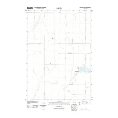
2010 Map of Mead Lake West
USGS Topo · Published 2010About this map
The South Fork Eau Claire River and its northern counterpart dominate this Clark County landscape, defining a rural territory structured by a precise grid of county highways and local roads. In the eastern portion of the map, the Mead 2WP862 Dam creates the expanse of Mead Lake, a focal point for recreation at the Veterans Memorial County Park Camp. The terrain features the distinct Bowler Valley and is drained by numerous named waterways including Popple River, Black Creek, and Dickinson Creek. For those researching local history, the centrally located Butler Cemetery remains a significant landmark amidst the agricultural fields. This survey illustrates the modern configuration of the Eau Claire River watershed just before the turn of the decade, showing how the local road network, such as County Hwy-MM and Capital Rd, provides access across this river-carved terrain.
Find a feature on this map
30 named features on this map. Tap any name to fly to it.
Don’t see what you’re looking for? This feature index may not catch every label — zoom into the map to look around manually.
Map Details
Editions of this 2010 Mead Lake West Map
This is the sole edition of this map. No revisions or reprints were ever made.
Other maps of this area

1948 · Fairchild
USGS Topo · 1:62,500

1949 · Fairchild
USGS Topo · 1:62,500

1952 · Stanley
USGS Topo · 1:62,500

1953 · Neillsville
USGS Topo · 1:62,500

1953 · Owen
USGS Topo · 1:48,000

1953 · Eau Claire
USGS Topo · 1:250,000

1958 · Eau Claire
USGS Topo · 1:250,000

1963 · Owen
USGS Topo · 1:62,500

1964 · Eau Claire
USGS Topo · 1:250,000
1976 · Stanley NE
USGS Topo · 1:24,000