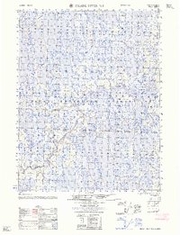
1962 Map of Meade River D-2
USGS Topo · Published 1962About this map
Naval Petroleum Reserve No 4 dominates this stretch of the Arctic coastal plain, showing a landscape defined by an intricate network of lakes, marshes, and wandering river channels. The terrain is bisected by the Inaru River and the Kuahrook River, which meander through the tundra. This mid-century survey reflects the era of cold-war resource exploration in the far north, where human presence was sparse and utilitarian. A single Tractor Trail provides a tenuous connection across the wet ground, while a lone Cabin and another Cabin (abandoned) near the eastern edge represent the only structural landmarks. Small tributaries like Niklikpuk Creek feed into the larger river systems, illustrating the complex hydrology of the North Slope before modern development altered the region's accessibility.
Find a feature on this map
7 named features on this map. Tap any name to fly to it.
Don’t see what you’re looking for? This feature index may not catch every label — zoom into the map to look around manually.
Map Details
Editions of this 1962 Meade River D-2 Map
This is the sole edition of this map. No revisions or reprints were ever made.
Other maps of this area

1945 · Barrow
USGS Topo · 1:250,000

1949 · Barrow
USGS Topo · 1:250,000

1951 · Meade River
USGS Topo · 1:250,000

1955 · Barrow
USGS Topo · 1:250,000

1955 · Meade River
USGS Topo · 1:250,000

1955 · Barrow A-4
USGS Topo · 1:63,360

1955 · Barrow A-5
USGS Topo · 1:63,360

1955 · Meade River C-1
USGS Topo · 1:63,360

1955 · Meade River D-2
USGS Topo · 1:63,360

1955 · Meade River C-3
USGS Topo · 1:63,360