
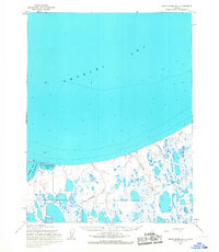
1955 Map of Meade River D-3
USGS Topo · Published 1967About this map
Skull Cliff marks a dramatic transition on this Arctic coastal landscape, where the high ground meets the Chukchi Sea. The interior is defined by a dense network of oriented thaw lakes and meandering drainages, including Kikoligaruk Creek and Niklavik Creek. A notable Oil Seep near the coast points to the underlying geology that would later define the region's industrial focus, while the presence of a Winter Trail and Tractor Trail reflects the vital, season-dependent transportation routes required for moving equipment and supplies across the permafrost. The southern portion of the sheet is dominated by the Inaru River, which winds through a low-lying marshy plain, illustrating the complex hydrology of the North Slope. These topographic details, from the narrow banks of Skull Creek to the broad reach of Tractor Lake, document a landscape primarily accessed for scientific and resource exploration in the mid-1950s.
Find a feature on this map
13 named features on this map. Tap any name to fly to it.
Don’t see what you’re looking for? This feature index may not catch every label — zoom into the map to look around manually.
Map Details
Editions of this 1955 Meade River D-3 Map
This is the sole edition of this map. No revisions or reprints were ever made.
Other maps of this area

1945 · Barrow
USGS Topo · 1:250,000

1949 · Barrow
USGS Topo · 1:250,000

1951 · Meade River
USGS Topo · 1:250,000

1955 · Barrow
USGS Topo · 1:250,000

1955 · Meade River
USGS Topo · 1:250,000

1955 · Barrow A-5
USGS Topo · 1:63,360

1955 · Meade River D-2
USGS Topo · 1:63,360

1955 · Meade River C-3
USGS Topo · 1:63,360
1955 · Meade River D-4
USGS Topo · 1:63,360

1955 · Meade River C-4
USGS Topo · 1:63,360