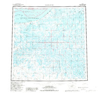
1955 Map of Meade River
USGS Topo · Published 1982About this map
Meade River snakes through a sprawling network of thaw lakes and wetlands in this 1955 survey of Alaska's North Slope. The landscape is defined by its coastal features along the Chukchi Sea, including the protective barrier of the Seahorse Islands and the prominent Pt Franklin. Inland, the map reveals the early industrial footprint within the National Petroleum Reserve in Alaska, marked by isolated exploration sites such as Meade Well No 1 and Kugrua Well No 1.
Find a feature on this map
48 named features on this map. Tap any name to fly to it.
Don’t see what you’re looking for? This feature index may not catch every label — zoom into the map to look around manually.
Map Details
Editions of this 1955 Meade River Map
3 editions found

Other maps of this area

1945 · Barrow
USGS Topo · 1:250,000

1949 · Barrow
USGS Topo · 1:250,000

1951 · Utukok River
USGS Topo · 1:250,000

1951 · Meade River
USGS Topo · 1:250,000

1951 · Wainwright
USGS Topo · 1:250,000

1951 · Lookout Ridge
USGS Topo · 1:250,000

1951 · Teshekpuk
USGS Topo · 1:250,000

1951 · Ikpikpuk River
USGS Topo · 1:250,000

1955 · Barrow
USGS Topo · 1:250,000

1955 · Teshekpuk
USGS Topo · 1:250,000