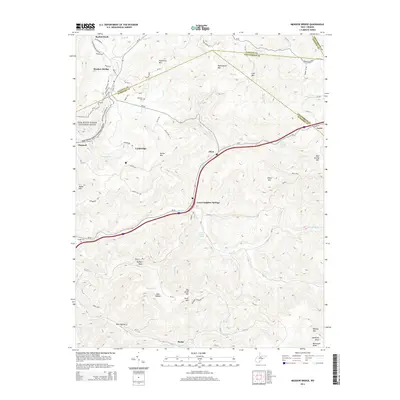
2014 Map of Meadow Bridge
USGS Topo · Published 2014About this map
Meadow Bridge and the surrounding highlands of the Fayette, Summers, and Greenbrier county borders are captured here as they appeared in 2014. The terrain is defined by the winding course of Meadow Cr and the presence of the New River Gorge National River along the western edge. Small communities like Green Sulphur Springs, Lockbridge, and Elton are connected by narrow mountain roads, while higher elevations are marked by prominent peaks such as Patterson Mtn and Wallowhole Mtn. Local history is preserved in sites like the Wickline Cem and Bragg Cem, which stand as landmarks for genealogists. The landscape transition between the river gorge and the interior plateaus is evident, with named hollows and springs like Dark Hollow and James Harless Spring indicating the rural, water-carved character of the region.
Find a feature on this map
66 named features on this map. Tap any name to fly to it.
Don’t see what you’re looking for? This feature index may not catch every label — zoom into the map to look around manually.
Map Details
Editions of this 2014 Meadow Bridge Map
This is the sole edition of this map. No revisions or reprints were ever made.
Other maps of this area

1887 · Hinton
USGS Topo · 1:125,000

1892 · Hinton
USGS Topo · 1:125,000

1912 · Meadow Creek
USGS Topo · 1:48,000

1912 · Big Bend
USGS Topo · 1:62,500

1914 · Big Bend
USGS Topo · 1:62,500

1915 · Meadow Creek
USGS Topo · 1:62,500

1921 · Alderson
USGS Topo · 1:48,000

1921 · Clintonville
USGS Topo · 1:48,000

1923 · Clintonville
USGS Topo · 1:62,500
1923 · Alderson
USGS Topo · 1:62,500