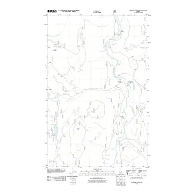
2011 Map of Meadow Creek
USGS Topo · Published 2011About this map
The Moyie River carves a deep valley through this northern Idaho landscape, serving as the central corridor for both geography and transit. This 2011 survey details the area around the small settlements of Meadow Creek and Eileen, where the river is joined by various tributaries including Rutledge Creek, McDougal Creek, and the namesake Meadow Creek. The terrain is defined by significant elevations such as Wall Mountain in the northwest and Dawson Ridge to the southwest, framing a landscape managed for both recreation and resource access.
Find a feature on this map
24 named features on this map. Tap any name to fly to it.
Don’t see what you’re looking for? This feature index may not catch every label — zoom into the map to look around manually.
Map Details
Editions of this 2011 Meadow Creek Map
This is the sole edition of this map. No revisions or reprints were ever made.
Other maps of this area

1911 · Priest Lake
USGS Topo · 1:250,000

1913 · Priest Lake
USGS Topo · 1:250,000

1958 · Sandpoint
USGS Topo · 1:250,000

1963 · Sandpoint
USGS Topo · 1:250,000
1965 · Curley Creek
USGS Topo · 1:24,000

1965 · Meadow Creek
USGS Topo · 1:24,000

1965 · Eastport
USGS Topo · 1:24,000

1965 · Ritz
USGS Topo · 1:24,000
1965 · Line Point
USGS Topo · 1:24,000
1965 · Moyie Springs
USGS Topo · 1:24,000