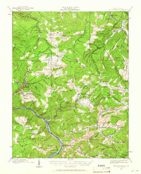
1912 Map of Meadow Creek
USGS Topo · Published 1966About this map
Sewell Mountain dominates the topography of this Fayette County survey, which provides a detailed look at the rural landscape and early coal-era settlements prior to the First World War. The region is characterized by a dense network of one-room schoolhouses, including the uniquely named Rock of Ages School and Ebenezer School, reflecting the scattered nature of community life in the hills. The Chesapeake and Ohio RR follows the winding path of the New River at the southern edge, connecting riverfront stops like Sandstone and New Richmond to the broader industrial economy.
Find a feature on this map
143 named features on this map. Tap any name to fly to it.
Don’t see what you’re looking for? This feature index may not catch every label — zoom into the map to look around manually.
Map Details
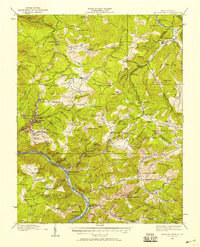
Editions of this 1912 Meadow Creek Map
3 editions found

Other maps of this area

1887 · Hinton
USGS Topo · 1:125,000

1889 · Nicholas
USGS Topo · 1:125,000

1891 · Nicholas
USGS Topo · 1:125,000

1891 · Raleigh
USGS Topo · 1:125,000

1892 · Hinton
USGS Topo · 1:125,000

1897 · Kanawha Falls
USGS Topo · 1:125,000

1897 · Raleigh
USGS Topo · 1:125,000

1900 · Kanawha Falls
USGS Topo · 1:125,000

1901 · Nicholas
USGS Topo · 1:125,000

1901 · Kanawha Falls
USGS Topo · 1:125,000