
1912 Map of Meadow Creek
USGS Topo · Published 1912About this map
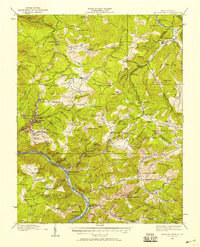
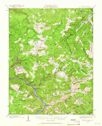
Sewell Mountain and the surrounding peaks of the Allegheny Mountains define this 1912 survey, which covers a region where the borders of Fayette, Greenbrier, Raleigh, and Summers counties meet. The landscape is characterized by a dense network of mountain schools and small settlements such as Rainelle and East Rainelle in the northeast, and Landisburg in the northwest. In the south, the New River carves a deep valley, punctuated by the dramatic Sandstone Falls. The distribution of dozens of educational buildings, including the Rock of Ages School, Eureka School, and Bragg School, reflects a highly decentralized rural population at the peak of the region's timber and early mining era. Local infrastructure is represented by features like Meadow Bridge and sidings along the rail lines such as Arthurs Siding, which served the burgeoning industrial interests of the Meadow River valley.
Find a feature on this map
116 named features on this map. Tap any name to fly to it.
Don’t see what you’re looking for? This feature index may not catch every label — zoom into the map to look around manually.
Map Details
Editions of this 1912 Meadow Creek Map
3 editions found
Other maps of this area

1887 · Hinton
USGS Topo · 1:125,000

1889 · Nicholas
USGS Topo · 1:125,000

1891 · Nicholas
USGS Topo · 1:125,000

1891 · Raleigh
USGS Topo · 1:125,000

1892 · Hinton
USGS Topo · 1:125,000

1897 · Kanawha Falls
USGS Topo · 1:125,000

1897 · Raleigh
USGS Topo · 1:125,000

1900 · Kanawha Falls
USGS Topo · 1:125,000

1901 · Nicholas
USGS Topo · 1:125,000

1901 · Kanawha Falls
USGS Topo · 1:125,000