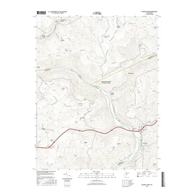
2016 Map of Meadow Creek
USGS Topo · Published 2016About this map
New River Gorge National River bisects this landscape, marking a deep incision where the New River carves through the highlands of Fayette, Raleigh, and Summers Counties. The river's path is punctuated by the dramatic Sandstone Falls and the engineering of the Mary Draper Ingles Bridge near Sandstone. High above the riverbanks, scattered upland settlements like Backus, Abraham, and Lawton are connected by a network of ridge roads including Backus Mtn Rd and Plumley Mountain Rd. Genealogists will find a wealth of family-named sites, including Harrah Cem, Goddard Cem, and Goodson Cem, alongside established landmarks like New Salem Church Cem and Saint Colmans Cem. This 2016 survey illustrates the modern configuration of small Appalachian communities such as Meadow Creek and Beurytown, where the topography dictated the slow growth of local infrastructure across peaks like Irish Mtn and Plumley Mtn.
Find a feature on this map
99 named features on this map. Tap any name to fly to it.
Don’t see what you’re looking for? This feature index may not catch every label — zoom into the map to look around manually.
Map Details
Editions of this 2016 Meadow Creek Map
This is the sole edition of this map. No revisions or reprints were ever made.
Other maps of this area

1887 · Hinton
USGS Topo · 1:125,000

1891 · Raleigh
USGS Topo · 1:125,000

1892 · Hinton
USGS Topo · 1:125,000

1897 · Raleigh
USGS Topo · 1:125,000

1902 · Raleigh
USGS Topo · 1:125,000

1911 · Flattop
USGS Topo · 1:48,000

1911 · Beckley
USGS Topo · 1:48,000

1912 · Meadow Creek
USGS Topo · 1:48,000

1912 · Big Bend
USGS Topo · 1:62,500

1913 · Beckley
USGS Topo · 1:62,500