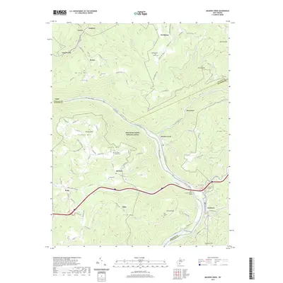
2019 Map of Meadow Creek
USGS Topo · Published 2019About this map
New River Gorge National River dominates this landscape, where the New River carves through the central highlands of West Virginia. The terrain is marked by significant peaks such as Backus Mtn and Plumley Mtn, with the deep river valley providing a corridor for both nature and travel. Small settlements like Meadow Creek, Abraham, and Backus are scattered throughout the heights and hollows, often centered around family landmarks and community sites like the Bragg School-Abraham and New Salem Church Cem. Genealogists will find a variety of local burial grounds, including Harrah Cem and Saint Colman's Cem. The southern reach of the map features notable river landmarks including Sandstone Falls and the Mary Draper Ingles Bridge, highlighting the convergence of modern infrastructure and natural waterway features in the New River valley.
Find a feature on this map
99 named features on this map. Tap any name to fly to it.
Don’t see what you’re looking for? This feature index may not catch every label — zoom into the map to look around manually.
Map Details
Editions of this 2019 Meadow Creek Map
This is the sole edition of this map. No revisions or reprints were ever made.
Other maps of this area

1887 · Hinton
USGS Topo · 1:125,000

1891 · Raleigh
USGS Topo · 1:125,000

1892 · Hinton
USGS Topo · 1:125,000

1897 · Raleigh
USGS Topo · 1:125,000

1902 · Raleigh
USGS Topo · 1:125,000

1911 · Flattop
USGS Topo · 1:48,000

1911 · Beckley
USGS Topo · 1:48,000

1912 · Meadow Creek
USGS Topo · 1:48,000

1912 · Big Bend
USGS Topo · 1:62,500

1913 · Beckley
USGS Topo · 1:62,500