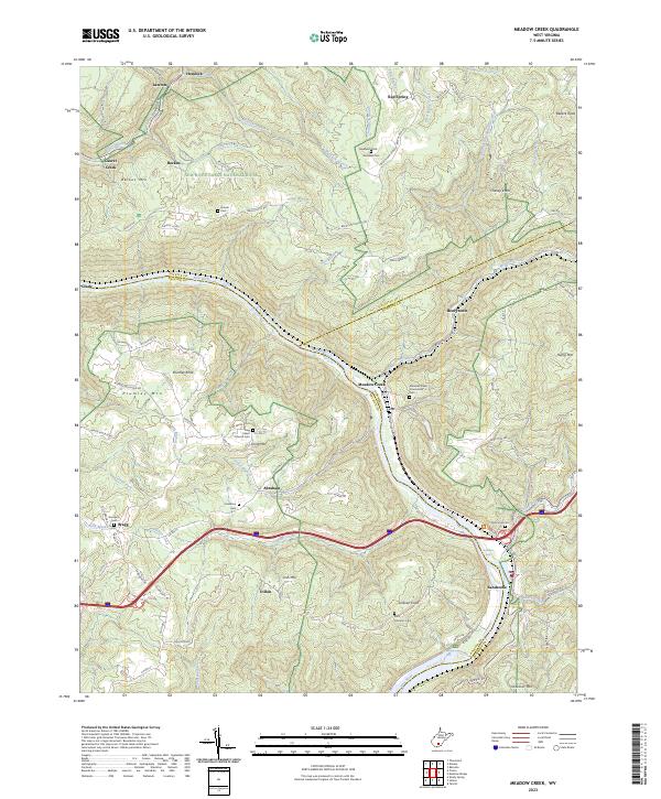
2023 Map of Meadow Creek
USGS Topo · Published 2023About this map
Sandstone Falls and Richman Falls anchor the southern reaches of this landscape, where the New River carves through the central highlands of West Virginia. This modern survey illustrates the rugged convergence of Raleigh, Fayette, and Summers counties within the New River Gorge National River boundaries. Small settlements like Meadow Creek, Abraham, and Dillon are linked by a network of rural routes such as Backus Mtn Rd and Clayton-Judson Rd, reflecting the persistent topography of the Allegheny Plateau.
Find a feature on this map
99 named features on this map. Tap any name to fly to it.
Don’t see what you’re looking for? This feature index may not catch every label — zoom into the map to look around manually.
Map Details
Editions of this 2023 Meadow Creek Map
This is the sole edition of this map. No revisions or reprints were ever made.
Other maps of this area

1887 · Hinton
USGS Topo · 1:125,000

1891 · Raleigh
USGS Topo · 1:125,000

1892 · Hinton
USGS Topo · 1:125,000

1897 · Raleigh
USGS Topo · 1:125,000

1902 · Raleigh
USGS Topo · 1:125,000

1911 · Flattop
USGS Topo · 1:48,000

1911 · Beckley
USGS Topo · 1:48,000

1912 · Meadow Creek
USGS Topo · 1:48,000

1912 · Big Bend
USGS Topo · 1:62,500

1913 · Beckley
USGS Topo · 1:62,500