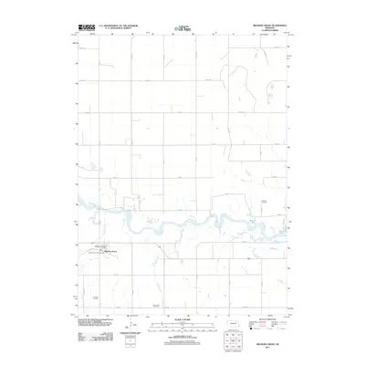
2011 Map of Meadow Grove
USGS Topo · Published 2011About this map
The village of Meadow Grove sits at the southern edge of the Elkhorn River valley, a central point in this rural Nebraska landscape. The settlement is tightly organized around the Meadow Grove Post Office and Wayside Park Campground, reflecting the local importance of this community hub near the turn of the 21st century. The map reveals the critical role of water management and natural drainage in the region, with Buffalo Creek and Deer Creek feeding into the meandering path of the Elkhorn River, which has carved out several oxbows including Jackson Lake and Wendis Lake.
Find a feature on this map
36 named features on this map. Tap any name to fly to it.
Don’t see what you’re looking for? This feature index may not catch every label — zoom into the map to look around manually.
Map Details
Editions of this 2011 Meadow Grove Map
This is the sole edition of this map. No revisions or reprints were ever made.
Other maps of this area

1955 · Sioux City
USGS Topo · 1:250,000

1955 · Fremont
USGS Topo · 1:250,000

1957 · Fremont
USGS Topo · 1:250,000

1958 · Sioux City
USGS Topo · 1:250,000

1958 · Fremont
USGS Topo · 1:250,000

1959 · Sioux City
USGS Topo · 1:250,000

1963 · Pierce NW
USGS Topo · 1:24,000

1963 · Battle Creek
USGS Topo · 1:24,000

1963 · Pierce SE
USGS Topo · 1:24,000

1963 · Emerick
USGS Topo · 1:24,000