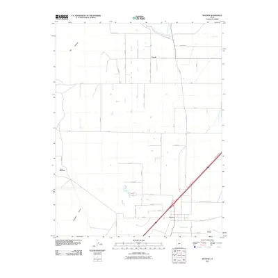
2011 Map of Meadow
USGS Topo · Published 2011About this map
The town of Meadow and the nearby agricultural hub of Flowell anchor this survey of the eastern Pahvant Valley in the early 2000s. The landscape is defined by the sharp transition between the irrigated valley floor and the volcanic features to the north and west. Geological landmarks like White Mountain and the dark, basaltic terrain of The Cinders stand in contrast to the strictly gridded network of rural roads such as W 1200 North and W 4100 S. Water management is central to life here, evidenced by the Central Utah Canal and natural flows from Chalk Crk and Meadow Creek. Genealogists will find the Meadow Cemetery clearly marked, while local researchers can trace the course of Walker Creek and the historical access provided by Meadow Creek Canyon Rd.
Find a feature on this map
27 named features on this map. Tap any name to fly to it.
Don’t see what you’re looking for? This feature index may not catch every label — zoom into the map to look around manually.
Map Details
Editions of this 2011 Meadow Map
This is the sole edition of this map. No revisions or reprints were ever made.
Other maps of this area

1885 · Beaver
USGS Topo · 1:250,000

1885 · Sevier Desert
USGS Topo · 1:250,000

1953 · Richfield
USGS Topo · 1:250,000

1953 · Delta
USGS Topo · 1:250,000

1958 · Richfield
USGS Topo · 1:250,000

1958 · Delta
USGS Topo · 1:250,000

1960 · Meadow
USGS Topo · 1:24,000

1961 · Fillmore
USGS Topo · 1:24,000

1962 · Delta
USGS Topo · 1:250,000

1962 · Fillmore
USGS Topo · 1:62,500