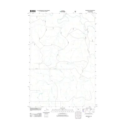
2012 Map of Meadow NE
USGS Topo · Published 2012About this map
The Grand River meanders across the northern portion of this South Dakota landscape, defining the local drainage and topography in the Rock Creek District of Corson County. The terrain is characterized by the winding path of Cottonwood Cr in the south, reflecting the open, water-carved prairie typical of this region. Human presence is marked by the long stretch of Hudgins Rd, which serves as a primary east-west artery through this expansive landscape. Produced in cooperation with the U.S. Forest Service, the map illustrates a network of backroads and trails that follow the natural contours of the plains, offering a clear view of the rural infrastructure at the beginning of the second decade of the 20th century.
Find a feature on this map
3 named features on this map. Tap any name to fly to it.
Don’t see what you’re looking for? This feature index may not catch every label — zoom into the map to look around manually.
Map Details
Editions of this 2012 Meadow NE Map
This is the sole edition of this map. No revisions or reprints were ever made.
Other maps of this area

1953 · McIntosh
USGS Topo · 1:250,000

1954 · Lemmon
USGS Topo · 1:250,000

1957 · Lemmon
USGS Topo · 1:250,000

1958 · McIntosh
USGS Topo · 1:250,000

1972 · Black Horse Butte NW
USGS Topo · 1:24,000

1972 · Black Horse Butte
USGS Topo · 1:24,000

1972 · Thunder Hawk SW
USGS Topo · 1:24,000

1980 · McIntosh
USGS Topo · 1:100,000
1983 · Lemmon Lake
USGS Topo · 1:24,000

1983 · Meadow NW
USGS Topo · 1:24,000