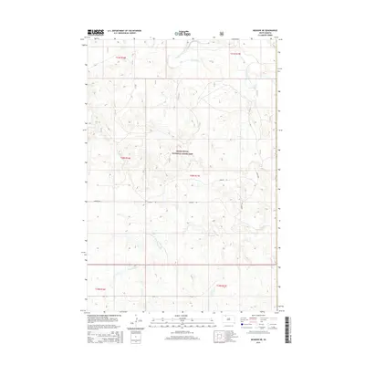
2015 Map of Meadow NE
USGS Topo · Published 2015About this map
Grand River National Grassland dominates this section of the Rock Creek District, where the high plains of South Dakota meet the winding path of the Grand River. This 2015 survey reveals a sparse, vast landscape defined by public lands and significant drainage systems, including the southern flow of Cottonwood Cr. The land is meticulously gridded by township and range lines, such as t20n r17e, showing the enduring impact of the Public Land Survey System on the western prairie. Transportation in this corner of Corson County is limited to a few arterial routes like Hudgins Rd and 122nd St, which cross the rolling terrain between the river and the grassland boundary. This map captures the modern state of these protected lands, preserving the character of the open range as it exists in the early twenty-first century.
Find a feature on this map
11 named features on this map. Tap any name to fly to it.
Don’t see what you’re looking for? This feature index may not catch every label — zoom into the map to look around manually.
Map Details
Editions of this 2015 Meadow NE Map
This is the sole edition of this map. No revisions or reprints were ever made.
Other maps of this area

1953 · McIntosh
USGS Topo · 1:250,000

1954 · Lemmon
USGS Topo · 1:250,000

1957 · Lemmon
USGS Topo · 1:250,000

1958 · McIntosh
USGS Topo · 1:250,000

1972 · Black Horse Butte NW
USGS Topo · 1:24,000

1972 · Black Horse Butte
USGS Topo · 1:24,000

1972 · Thunder Hawk SW
USGS Topo · 1:24,000

1980 · McIntosh
USGS Topo · 1:100,000
1983 · Lemmon Lake
USGS Topo · 1:24,000

1983 · Meadow NW
USGS Topo · 1:24,000