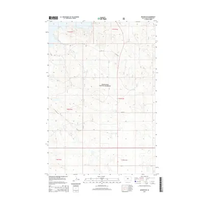
2015 Map of Meadow NW
USGS Topo · Published 2015About this map
Grand River National Grassland dominates this section of the western South Dakota plains, where the open landscape is defined by the Public Land Survey System's rigid grid. The terrain is structured by township lines such as t20n r16e, illustrating the methodical division of these expansive grasslands for management and ranching. Access through this sparsely populated Perkins County territory relies on a network of rural routes, including S Cabin Rd and Bald Butte Rd, which navigate the subtle draws and rises characteristic of the region. This 2015 survey by the U.S. Geological Survey preserves the specific layout of these service roads and pasture boundaries, providing a clear record of land use in a region where the natural environment and administrative boundaries are deeply intertwined.
Find a feature on this map
12 named features on this map. Tap any name to fly to it.
Don’t see what you’re looking for? This feature index may not catch every label — zoom into the map to look around manually.
Map Details
Editions of this 2015 Meadow NW Map
This is the sole edition of this map. No revisions or reprints were ever made.
Other maps of this area

1954 · Lemmon
USGS Topo · 1:250,000

1957 · Lemmon
USGS Topo · 1:250,000

1983 · Haynes SE
USGS Topo · 1:24,000

1983 · Boxcar Buttes
USGS Topo · 1:24,000
1983 · Lemmon Lake
USGS Topo · 1:24,000

1983 · Bison NE
USGS Topo · 1:24,000

1983 · Meadow NW
USGS Topo · 1:24,000

1983 · Meadow
USGS Topo · 1:24,000
1983 · Meadow SE
USGS Topo · 1:24,000
1983 · Meadow NE
USGS Topo · 1:24,000