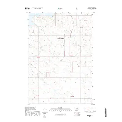
2017 Map of Meadow NW
USGS Topo · Published 2017About this map
Grand River National Grassland dominates this section of Perkins County, South Dakota, defining a landscape of open range and expansive management units. To the north, the southern reaches of Shadehill Reservoir provide a significant aquatic break in the grassland, indicating the importance of water management in this arid region. The network of local routes, including Old US Hwy 73 and the family-named Hudgins Rd, reveals the sparse but intentional infrastructure used for ranching and public land access. This 2017 survey shows how the Public Land Survey System continues to divide the territory into distinct townships like t20n r16e, a structural legacy that still dictates property boundaries and grazing allotments today.
Find a feature on this map
12 named features on this map. Tap any name to fly to it.
Don’t see what you’re looking for? This feature index may not catch every label — zoom into the map to look around manually.
Map Details
Editions of this 2017 Meadow NW Map
This is the sole edition of this map. No revisions or reprints were ever made.
Other maps of this area

1954 · Lemmon
USGS Topo · 1:250,000

1957 · Lemmon
USGS Topo · 1:250,000

1983 · Haynes SE
USGS Topo · 1:24,000

1983 · Boxcar Buttes
USGS Topo · 1:24,000
1983 · Lemmon Lake
USGS Topo · 1:24,000

1983 · Bison NE
USGS Topo · 1:24,000

1983 · Meadow NW
USGS Topo · 1:24,000

1983 · Meadow
USGS Topo · 1:24,000
1983 · Meadow SE
USGS Topo · 1:24,000
1983 · Meadow NE
USGS Topo · 1:24,000