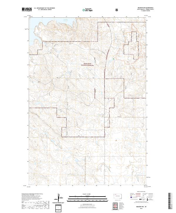
2021 Map of Meadow NW
USGS Topo · Published 2021About this map
Grand River National Grassland encompasses a significant portion of this South Dakota landscape, where the rolling plains are defined by section lines and administrative boundaries. The northern edge of the sheet reaches the southern shoreline of the Shadehill Reservoir, indicating a transition from the semi-arid grasslands to the managed waters of the Grand River system. The settlement pattern is characterized by scattered ranch access roads rather than dense townships, reflecting the late twentieth and early twenty-first-century reliance on regional transit routes.
Find a feature on this map
14 named features on this map. Tap any name to fly to it.
Don’t see what you’re looking for? This feature index may not catch every label — zoom into the map to look around manually.
Map Details
Editions of this 2021 Meadow NW Map
This is the sole edition of this map. No revisions or reprints were ever made.
Other maps of this area

1954 · Lemmon
USGS Topo · 1:250,000

1957 · Lemmon
USGS Topo · 1:250,000

1983 · Haynes SE
USGS Topo · 1:24,000

1983 · Boxcar Buttes
USGS Topo · 1:24,000
1983 · Lemmon Lake
USGS Topo · 1:24,000

1983 · Bison NE
USGS Topo · 1:24,000

1983 · Meadow NW
USGS Topo · 1:24,000

1983 · Meadow
USGS Topo · 1:24,000
1983 · Meadow SE
USGS Topo · 1:24,000
1983 · Meadow NE
USGS Topo · 1:24,000