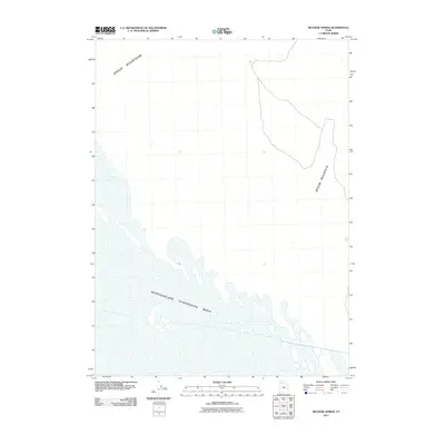
2011 Map of Meadow Spring
USGS Topo · Published 2011About this map
Newfoundland Evaporation Basin dominates the lower landscape of this Box Elder County terrain, illustrating the hydrologic patterns and industrial use of Utah's salt flats in the early twenty-first century. The basin's expanse serves as a stark contrast to the high ground of the Hogup Mountains in the northwest and Broom Mountain to the east. These geological features define the corridor of the Great Salt Lake Desert, where water sources like Meadow Spring were essential for early navigation and survival. This survey provides a precise look at the contours and elevations of these remote ranges, recording the intersection of natural salt-crust formations and mountain topography in a region defined by its extreme arid environment.
Find a feature on this map
4 named features on this map. Tap any name to fly to it.
Don’t see what you’re looking for? This feature index may not catch every label — zoom into the map to look around manually.
Map Details
Editions of this 2011 Meadow Spring Map
This is the sole edition of this map. No revisions or reprints were ever made.
Other maps of this area

1954 · Brigham City
USGS Topo · 1:250,000

1958 · Brigham City
USGS Topo · 1:250,000

1962 · Brigham City
USGS Topo · 1:250,000

1969 · Dolphin Island West
USGS Topo · 1:24,000

1969 · Hogup Ridge South
USGS Topo · 1:24,000

1969 · Hogup Ridge North
USGS Topo · 1:24,000

1983 · Desert Peak
USGS Topo · 1:24,000

1983 · Round Mountain NW
USGS Topo · 1:24,000

1983 · Sheep Mountain
USGS Topo · 1:24,000

1983 · Groome
USGS Topo · 1:24,000