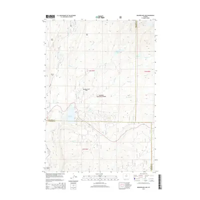
2015 Map of Meadowlark Lake
USGS Topo · Published 2015About this map
The Bighorn National Forest defines this high-elevation landscape, where numerous tributaries of the Tensleep drainage converge. At the center of the sheet, Meadow Lark Lake and the Tensleep Reservoir serve as significant water management features within the rugged mountain terrain. The map captures the complex hydrology of the region, including E Tensleep Cr, W Tensleep Cr, and Bull Cr, which flow through deep-cut valleys toward the southwest.
Find a feature on this map
33 named features on this map. Tap any name to fly to it.
Don’t see what you’re looking for? This feature index may not catch every label — zoom into the map to look around manually.
Map Details
Editions of this 2015 Meadowlark Lake Map
This is the sole edition of this map. No revisions or reprints were ever made.
Other maps of this area

1899 · Cloud peak
USGS Topo · 1:125,000

1901 · Cloud Peak
USGS Topo · 1:125,000

1955 · Sheridan
USGS Topo · 1:250,000

1958 · Sheridan
USGS Topo · 1:250,000

1960 · Lake Solitude
USGS Topo · 1:24,000

1962 · Sheridan
USGS Topo · 1:250,000
1967 · Onion Gulch
USGS Topo · 1:24,000
1967 · Old Maid Gulch
USGS Topo · 1:24,000

1967 · Brokenback Narrows
USGS Topo · 1:24,000
1967 · Hazelton Peak
USGS Topo · 1:24,000