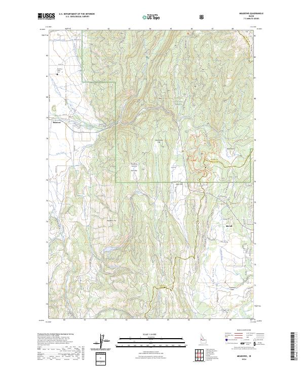
2024 Map of Meadows
USGS Topo · Published 2024About this map
Meadows Valley sits at the heart of this Idaho landscape, where the settlement of Meadows and the nearby Meadows Valley Cem mark the historical center of the local community. The transition from the valley floor to the timbered slopes of the Payette National Forest is defined by a series of distinct geographic benches and passes, including Ecks Flat, Moorehead Flat, and the Meadows Summit. Water management is evident through the network of the Campbell Ditch and South End Ditch, which redirect flow across the high meadows to support the region's agricultural interests.
Find a feature on this map
86 named features on this map. Tap any name to fly to it.
Don’t see what you’re looking for? This feature index may not catch every label — zoom into the map to look around manually.
Map Details
Editions of this 2024 Meadows Map
This is the sole edition of this map. No revisions or reprints were ever made.
Other maps of this area

1911 · Meadows
USGS Topo · 1:125,000

1938 · Riggins
USGS Topo · 1:96,000

1945 · Riggins
USGS Topo · 1:125,000

1954 · New Meadows
USGS Topo · 1:62,500

1955 · Baker
USGS Topo · 1:250,000

1955 · Grangeville
USGS Topo · 1:250,000

1959 · Baker
USGS Topo · 1:250,000

1959 · Grangeville
USGS Topo · 1:250,000

1963 · Bally Mountain
USGS Topo · 1:24,000

1963 · Granite Lake
USGS Topo · 1:24,000