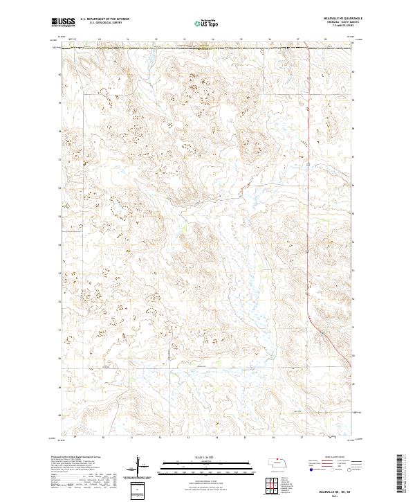
2021 Map of Meadville NE
USGS Topo · Published 2021About this map
The northern reaches of Holt Cr define this section of Keya Paha County along the Nebraska and South Dakota border. This landscape is shaped by the subtle drainage patterns of the High Plains, where Timber Cr cuts across the northwestern corner of the quadrangle. The map reveals the classic rectangular grid of the Public Land Survey System, with section lines and rural routes providing the primary structure for the few homesteads and ranches in this part of the state. The extensive wetland areas associated with the Holt Cr basin highlight the environmental character of the region, which remains primarily agricultural and sparsely settled. This survey provides a modern topographical record of the drainages and land divisions that have structured this borderland for over a century.
Find a feature on this map
2 named features on this map. Tap any name to fly to it.
Don’t see what you’re looking for? This feature index may not catch every label — zoom into the map to look around manually.
Map Details
Editions of this 2021 Meadville NE Map
This is the sole edition of this map. No revisions or reprints were ever made.
Other maps of this area

1950 · Meadville
USGS Topo · 1:24,000

1950 · Huddle Table
USGS Topo · 1:24,000

1955 · Mitchell
USGS Topo · 1:250,000

1955 · O'Neill
USGS Topo · 1:250,000

1959 · O'Neill
USGS Topo · 1:250,000

1959 · Mitchell
USGS Topo · 1:250,000

1964 · Dallas SW
USGS Topo · 1:24,000
1964 · Meadville NW
USGS Topo · 1:24,000
1964 · Springview
USGS Topo · 1:24,000
1964 · Springview NW
USGS Topo · 1:24,000