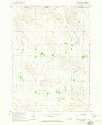
1964 Map of Meadville NW
USGS Topo · Published 1965About this map
The Rosebud Indian Reservation occupies the northern edge of this map, marking the border between South Dakota and Nebraska. This landscape at the mid-century transition is defined by the high plains of Keya Paha County, where ranching operations like the Schroeder Ranch and Weston Ranch are the primary landmarks. The presence of rural institutions such as Lost Creek Sch and Guide Rock Sch reflects the sparse but established settlement patterns of the sandhills region. The terrain is marked by the winding course of Cottonwood Creek and the distinct elevation of Guide Rock, which serves as a notable local landmark. Genealogists may find value in the location of the Heerten Cem, providing a precise point for family research in this quiet stretch of the borderlands.
Find a feature on this map
16 named features on this map. Tap any name to fly to it.
Don’t see what you’re looking for? This feature index may not catch every label — zoom into the map to look around manually.
Map Details
Editions of this 1964 Meadville NW Map
This is the sole edition of this map. No revisions or reprints were ever made.
Other maps of this area

1950 · Norden
USGS Topo · 1:62,500

1950 · Meadville
USGS Topo · 1:24,000

1950 · Huddle Table
USGS Topo · 1:24,000

1952 · Norden
USGS Topo · 1:62,500

1955 · Martin
USGS Topo · 1:250,000

1955 · Mitchell
USGS Topo · 1:250,000

1955 · O'Neill
USGS Topo · 1:250,000

1957 · Valentine
USGS Topo · 1:250,000

1958 · Martin
USGS Topo · 1:250,000

1959 · Valentine
USGS Topo · 1:250,000