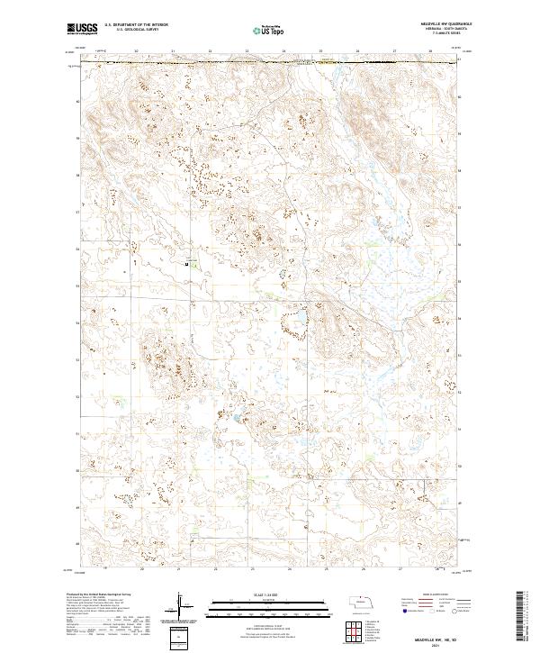
2021 Map of Meadville NW
USGS Topo · Published 2021About this map
The state line between Nebraska and South Dakota defines the northern edge of this high plains landscape, where Tripp County meets Keya Paha County. This sparsely settled region is characterized by the drainage of Cottonwood Creek, which winds through the eastern half of the survey area. For local historians and genealogists, the map preserves the location of the Lost Creek Cemetery, a solitary landmark in the western interior. Infrastructure is minimal, consisting primarily of section-line roads like 426th Ave that navigate the varied terrain of these northern borderlands. The map reflects a modern view of a durable agricultural landscape, maintaining the original Public Land Survey System grids across townships like t35n r23w and t34n r22w.
Find a feature on this map
11 named features on this map. Tap any name to fly to it.
Don’t see what you’re looking for? This feature index may not catch every label — zoom into the map to look around manually.
Map Details
Editions of this 2021 Meadville NW Map
This is the sole edition of this map. No revisions or reprints were ever made.
Other maps of this area

1950 · Norden
USGS Topo · 1:62,500

1950 · Meadville
USGS Topo · 1:24,000

1950 · Huddle Table
USGS Topo · 1:24,000

1952 · Norden
USGS Topo · 1:62,500

1955 · Martin
USGS Topo · 1:250,000

1955 · Mitchell
USGS Topo · 1:250,000

1955 · O'Neill
USGS Topo · 1:250,000

1957 · Valentine
USGS Topo · 1:250,000

1958 · Martin
USGS Topo · 1:250,000

1959 · Valentine
USGS Topo · 1:250,000