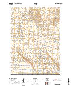
2020 Map of Mean Rock Well
USGS Topo · Published 2020About this map
Peters Cr flows through the northern reaches of this high desert terrain in Lake County, defining the drainage patterns of an arid landscape. The area is marked by established transit routes such as Stone House RD and the utility corridor following Powerline RD. These roads, along with Co Hwy 5-13 B, represent the essential infrastructure serving this remote section of the Oregon outback. The map clearly delineates the Public Land Survey System grid, including the boundaries of t24s r18e, t24s r19e, and t25s r19e. The topography is characterized by subtle elevation changes and seasonal watercourses, reflecting the pastoral and resource-based utility of the land in the early twenty-first century.
Find a feature on this map
7 named features on this map. Tap any name to fly to it.
Don’t see what you’re looking for? This feature index may not catch every label — zoom into the map to look around manually.
Map Details
Editions of this 2020 Mean Rock Well Map
This is the sole edition of this map. No revisions or reprints were ever made.
Other maps of this area

1955 · Crescent
USGS Topo · 1:250,000

1957 · Crescent
USGS Topo · 1:250,000

1958 · Crescent
USGS Topo · 1:250,000

1970 · Crescent
USGS Topo · 1:250,000

1981 · Fossil Lake
USGS Topo · 1:24,000

1981 · Sand Rock
USGS Topo · 1:24,000

1981 · Moonlight Butte
USGS Topo · 1:24,000

1981 · Mean Rock Well
USGS Topo · 1:24,000

1982 · Peters Creek Sink
USGS Topo · 1:24,000

1982 · Christmas Lake
USGS Topo · 1:24,000