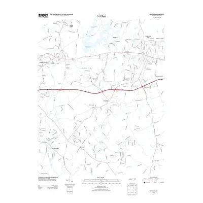
2013 Map of Mebane
USGS Topo · Published 2013About this map
The Haw River flows through the western edge of this 2013 survey, anchoring the industrial and residential corridors of Haw River town and Swepsonville. This portion of Alamance County reflects a landscape defined by its waterways, where the river's bend meets tributary systems like Back Cr and Haw Cr. Local transportation and aviation history is preserved through the locations of Hurdle Field Airport and Kimrey Airport, while small-scale residential developments like Florence Town and Brook Hollow appear alongside older agricultural place-names. In the northern reaches, the Quaker Creek Reservoir and Lake Michael provide significant water features that contrast with the dense network of local roads such as Green Level Church Rd and Stagecoach Trail. The map captures the suburbanization of the region, specifically near the growth of Mebane and established communities like Melville and Green Level.
Find a feature on this map
288 named features on this map. Tap any name to fly to it.
Don’t see what you’re looking for? This feature index may not catch every label — zoom into the map to look around manually.
Map Details
Editions of this 2013 Mebane Map
This is the sole edition of this map. No revisions or reprints were ever made.
Other maps of this area

1953 · Raleigh
USGS Topo · 1:250,000

1953 · Greensboro
USGS Topo · 1:250,000

1954 · Greensboro
USGS Topo · 1:250,000

1954 · Raleigh
USGS Topo · 1:250,000

1962 · Greensboro
USGS Topo · 1:250,000

1966 · Greensboro
USGS Topo · 1:250,000

1967 · Cedar Grove
USGS Topo · 1:24,000

1968 · White Cross
USGS Topo · 1:24,000

1968 · Efland
USGS Topo · 1:24,000

1969 · Burlington
USGS Topo · 1:24,000