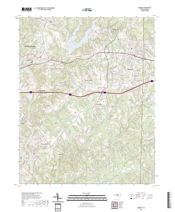
2022 Map of Mebane
USGS Topo · Published 2022About this map
Haw River carves a winding path through the center of this 2022 survey, anchoring a region defined by established textile-era towns and expanding residential pockets. The landscape transitions from the dense street grids of Mebane and eastern Graham to the more open, historically agrarian stretches near Hawfields and Melville. The Alamance Co Orange Co line bisects the eastern portion of the sheet, where Oakwood Cem and several community landmarks sit within the Mebane city limits.
Find a feature on this map
250 named features on this map. Tap any name to fly to it.
Don’t see what you’re looking for? This feature index may not catch every label — zoom into the map to look around manually.
Map Details
Editions of this 2022 Mebane Map
This is the sole edition of this map. No revisions or reprints were ever made.
Other maps of this area

1953 · Raleigh
USGS Topo · 1:250,000

1953 · Greensboro
USGS Topo · 1:250,000

1954 · Greensboro
USGS Topo · 1:250,000

1954 · Raleigh
USGS Topo · 1:250,000

1962 · Greensboro
USGS Topo · 1:250,000

1966 · Greensboro
USGS Topo · 1:250,000

1967 · Cedar Grove
USGS Topo · 1:24,000

1968 · White Cross
USGS Topo · 1:24,000

1968 · Efland
USGS Topo · 1:24,000

1969 · Burlington
USGS Topo · 1:24,000