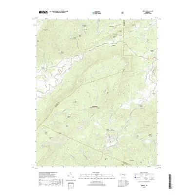
2019 Map of Mecca
USGS Topo · Published 2019About this map
Cherokee National Forest dominates this section of eastern Tennessee, where the steep ridges of Starr Mountain rise above the drainage of Conasauga Creek and Bullet Creek. The landscape is defined by its numerous family-named landmarks and small, scattered communities like Mecca, Macedonia, and Holly Springs. Genealogists will find a high density of burial sites across the terrain, including Adams Cemetery near Prospect and Hamby Cemetery located south of Ivy. The map illustrates a rural network of named hollows and ridges, such as Beasley Hollow and Hogback Ridge, that dictated the placement of early roads like Mecca Pike. Water features are central to the area's geography, ranging from the Bullet Creek Falls to the mineral-rich waters of White Cliff Springs and Gentry Spring.
Find a feature on this map
111 named features on this map. Tap any name to fly to it.
Don’t see what you’re looking for? This feature index may not catch every label — zoom into the map to look around manually.
Map Details
Editions of this 2019 Mecca Map
This is the sole edition of this map. No revisions or reprints were ever made.
Other maps of this area

1886 · Cleveland
USGS Topo · 1:125,000

1892 · Cleveland
USGS Topo · 1:125,000

1893 · Murphy
USGS Topo · 1:125,000

1895 · Cleveland
USGS Topo · 1:125,000

1901 · Cleveland
USGS Topo · 1:125,000

1914 · Murphy
USGS Topo · 1:125,000

1934 · Mount Vernon
USGS Topo · 1:24,000

1934 · Mecca
USGS Topo · 1:24,000

1934 · Englewood
USGS Topo · 1:24,000

1934 · Tellico Plains
USGS Topo · 1:24,000