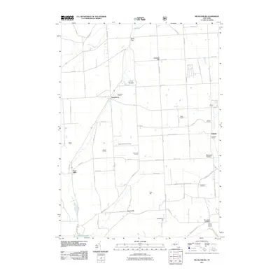
2011 Map of Mecklenburg
USGS Topo · Published 2011About this map
Mecklenburg and its surrounding rural hamlets are defined by a network of historic burial grounds and local airfields in this 2011 survey. The landscape is dotted with genealogical markers like the Carman Road Quaker Cemetery, McIntyre Settlement Cemetery, and Rumsey Hill Cemetery, which offer valuable coordinates for researchers tracing early regional families. This documentation of the area reveals a persistent agricultural character, where small clusters like Perry City and Trumbull Corners remain anchored by longstanding road intersections. Aviation history is quietly preserved at Willis Airport and Culver Airfield, while the southern reaches of the map transition into the high ground of Connecticut Hill and the northern tip of Cayuta Lake.
Find a feature on this map
64 named features on this map. Tap any name to fly to it.
Don’t see what you’re looking for? This feature index may not catch every label — zoom into the map to look around manually.
Map Details
Editions of this 2011 Mecklenburg Map
This is the sole edition of this map. No revisions or reprints were ever made.
Other maps of this area

1893 · Ithaca
USGS Topo · 1:62,500

1895 · Ithaca
USGS Topo · 1:62,500

1898 · Watkins Glen
USGS Topo · 1:62,500

1901 · Watkins
USGS Topo · 1:62,500

1902 · Genoa
USGS Topo · 1:62,500

1902 · Ovid
USGS Topo · 1:62,500

1905 · Watkins Glen
USGS Topo · 1:125,000

1942 · Ludlowville
USGS Topo · 1:24,000

1942 · Lodi
USGS Topo · 1:24,000

1942 · Trumansburg
USGS Topo · 1:24,000